
Club Costa Tropical · The Journal
10 Secret Alpujarra Routes: Hiking Without Crowds
From Capileira, 80 hikers from Almuñécar's program already tour the region; these 10 hidden routes take you further, along irrigation channels and abandoned villages. ## The Hidden Alpujarra: Beyond the Poqueira Valley The Alpujarra region stretches like an amphitheater of stone and water between
From Capileira, 80 hikers from Almuñécar's program already tour the region; these 10 hidden routes take you further, along irrigation channels and abandoned villages.
[[PHOTO:0]]
The Hidden Alpujarra: Beyond the Poqueira Valley
[[PHOTO:1]]
The Alpujarra region stretches like an amphitheater of stone and water between the provinces of Granada and Almería, with over 17 official routes cataloged by specialized guides.
The Hidden Alpujarra: Beyond the Poqueira Valley
[[PHOTO:2]]
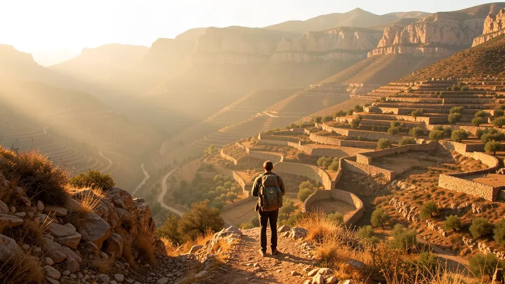
The region of La Alpujarra stretches like an amphitheater of stone and water between the provinces of Granada and Almería, with more than 17 official routes cataloged by specialized guides. However, the traveler who limits themselves to the famous Poqueira Valley —that triangle formed by Capileira, Bubión, and Pampaneira— barely scratches the surface of a territory that treasures hundreds of kilometers of medieval paths, royal drovers' roads, and trails that time has been erasing from conventional maps. The greatest tourist influx is concentrated in those three white villages perched on the hillside, but the true essence of the Alpujarra is discovered when one leaves the cobbled streets behind and steps onto the land of the irrigation channels.
The Andalusí road heritage constitutes the common thread of these ten secret routes that this article reveals, trails that connect with the history of abandoned villages and with a hydraulic system that still irrigates the terraced fields as it did centuries ago. The paths trodden today were once the arteries of a subsistence economy, where every trail had a purpose: taking livestock to the mountain passes, transporting silk to the markets of Granada, or connecting the scattered farmsteads with administrative centers. That network of trails, built and maintained during Nasrid rule, remains intact in many stretches, waiting for those who seek an experience far from the crowds.
The depopulation that afflicted the region during the 20th century left a trail of abandoned farmhouses and ghost towns that today stand as silent witnesses to an exodus that emptied the highest slopes. Those settlements, some of which barely appear on current maps, offer the hiker a journey into the past where vegetation reclaims its territory among crumbling walls and threshing floors covered in thyme. The routes proposed here traverse those settings, combining physical effort with rural archaeology and the observation of a nature that has recovered spaces abandoned by man.
The contrast between the bustle of the Poqueira Valley and the solitude of these alternative itineraries is abysmal, even in peak season. While in Capileira the parking lots fill up and restaurants multiply their prices, barely ten kilometers in a straight line there are trails where the walker can spend hours without crossing paths with another person. That difference in tourist pressure explains why connoisseurs prefer to lace up their boots in towns like Mecina Bombarón, Yegen, or Laroles, starting points for routes that run along ancient royal drovers' roads used for centuries for transhumance.
The irrigation channels, that marvel of hydraulic engineering inherited from the Arabs, set the rhythm of many of these routes, as their service paths allow one to traverse the mountain following the course of the water. These canals, which some authors date at over a thousand years old, not only irrigate the orchards but also trace a parallel map of perfectly leveled trails that serpentine along the contour lines with a gentle gradient. Following an irrigation channel is to delve into the logic of a landscape built by necessity, where every hand-placed stone serves a specific function and where the sound of water accompanies the walker for hours.
The choice of these ten routes responds to a dual criterion: on the one hand, their landscape and ethnographic value; on the other, their capacity to decongest a territory suffering from the effects of tourist success. The selected itineraries run through the municipal districts of the Almerían Alpujarra and eastern Granada, areas that have remained on the margins of the great flows of visitors and that preserve an authenticity increasingly difficult to find in Andalusia. The technical difficulty varies considerably among them, from accessible walks along old bridle paths to demanding ascents exceeding 2,000 meters in altitude.
It is worth remembering that the hidden Alpujarra is not a virgin territory, but a deeply humanized landscape that has been shaped for centuries by the hand of man. That humanization is precisely its greatest attraction, for every corner holds the memory of generations who knew how to adapt to an extreme orography with ingenuity and effort. The cultivation terraces, the threshing floors, the cisterns, and the public fountains are elements that dot these itineraries and turn every hike into a lesson in living history.
Arab Irrigation Channels: The Engineering That Created a Landscape
[[PHOTO:3]]
The water flows down singing through the acequia of Pitres, a thread of life that snakes between terraces of chestnut trees and centuries-old olive trees. This channel, built more than seven centuries ago by Andalusian engineers, still fulfills the same function today as it did then: carrying the snowmelt from Sierra Nevada to the cultivation terraces that climb the hillsides. Anyone walking along its banks discovers a hydraulic system of astonishing precision, where every diversion, every water divider, and every small sluice gate responds to an age-old logic of equitable distribution of the region's most precious resource.
The network of acequias in the Alpujarra constitutes one of the most important hydraulic legacies in the Iberian Peninsula. The Nasrid technicians designed a network of channels that capture water from the ravines and distribute it across the slopes, creating a mosaic of stepped plots that completely transforms the physiognomy of the terrain. Without this infrastructure, the arid slopes descending toward the Mediterranean would today be a barren landscape, incapable of sustaining the agriculture that has made the region famous.
The hiking routes that traverse the area allow visitors to appreciate this work of vernacular engineering up close. The path connecting Pitres with Mecina Fondales, for example, runs for long stretches parallel to one of the best-preserved acequias, offering walkers the opportunity to observe the irrigation system in full operation. In the spring and summer months, when the sluice gates are opened to irrigate the terraces, visitors can witness the ancestral ritual of the farmers who keep this legacy alive.
The acequia of Mecina Fondales has added value: the remains of ancient flour mills that harnessed the power of water to grind grain. These constructions, today mostly in ruins, speak of a self-sufficient economy that for centuries depended entirely on channeled water. Some of these mills still preserve their millstones and feeder channels, silent testimony to an activity that ceased decades ago but remains etched in the collective memory of the villages.
Interest in these water landscapes has transcended the local sphere. The municipal hiking program of Almuñécar, which has already surpassed eighty participants on some of its outings, has included in its calendar routes around the Bermejales Reservoir, where the interaction between modern hydraulic infrastructure and the remains of historical channels offers a revealing contrast. This institutional attention confirms that the acequias are not merely an element of the past, but a tourist and landscape resource of the first order.
Walking alongside these channels allows one to understand the fragility of the balance that sustains the Alpujarra. Each acequia requires constant maintenance, a labor of cleaning and repair that irrigation communities have been carrying out for generations. Hikers who traverse these paths thus become privileged witnesses to a system that combines tradition, technical knowledge, and respect for the natural environment.
The microecosystems that flourish in the vicinity of the acequias add additional appeal to these routes. The constant humidity generated by the channels fosters the appearance of exuberant vegetation that contrasts with the surrounding aridity: ferns, mosses, rushes, and a varied population of amphibians find unexpected refuge in these water corridors. The attentive hiker can observe dragonflies fluttering over the surface of the channel or hear the croaking of frogs at dusk.
Contemplating these works invites reflection on the capacity of civilizations to shape the territory sustainably. The builders of the acequias did not seek to dominate water, but to coexist with it, harnessing its force and generosity without altering natural cycles. That balance, maintained for centuries, constitutes a lesson in humility that contrasts with contemporary large-scale hydraulic infrastructure.
The routes that follow the course of the acequias also offer a journey through the social history of the region. Each village, each neighborhood, each irrigation community has left its mark on the layout of the channels, on the distribution agreements, on the disputes over water that punctuate municipal archives. The stroll alongside these channels thus becomes a journey through time that connects the walker with generations of farmers who tilled these lands.
The acequia of Pitres, which originates in the snowfields of the Tajo de los Machos peak, travels more than eight kilometers before emptying into the Río Sucio. Along its course, it passes through tunnels carved into the rock, crosses ravines via stone aqueducts, and branches into dozens of secondary arms that irrigate the orchards of the three population centers that make up the municipality. This technical complexity, resolved with local materials and knowledge passed down from father to son, deserves the attention of any visitor.
Hiking thus reveals itself as the best tool for discovering and valuing this heritage. The routes that run alongside the acequias allow a leisurely, respectful approach that fosters understanding of the historical and natural processes that have shaped the Alpujarra landscape. Each step beside the singing water is an invitation to pause, observe, and learn from a wisdom that remains alive in the stones, in the channels, and in the hands of those who maintain them.
Cañadas reales: the medieval highways of livestock
[[PHOTO:4]]
Before the country roads and asphalted paths that today wind between white villages existed, transhumant livestock marked the geography of the Alpujarra with a network of livestock trails that historians compare to medieval highways. The Cañada Real de la Contraviesa, one of the most significant, still runs today as a connecting thread between Sierra Nevada and the Mediterranean, offering the walker a journey in reverse to that made by the shepherds: instead of following the flock, one follows the trail of an economic system that sustained the region for centuries. These corridors, which in their day mobilized thousands of head of cattle between the high pastures and the natural wintering grounds of the coast, now remain in an administrative limbo, without official signage and with stretches that only locals know with precision.
The lack of maintenance has partially erased the original route in some points, but where the cañada is preserved, the landscape unfolds with a generosity that few official routes can match. From the heights of la Contraviesa, the view encompasses the Alborán Sea to the south and the snowy peaks to the north, a panorama that explains why the ancient herders chose these elevations for their journeys. Along the route appear the remains of infrastructure associated with livestock transit: resting areas where the animals regained their strength, watering troughs carved in stone and, in some cases, the ruins of old shearing stations that operated well into the 20th century. These elements, invisible to conventional tourism, turn every excursion into a lesson in rural archaeology.
While organized hiking grows in the region —the municipal program of Almuñécar, for example, has recorded a 20% increase in participation during the last year—, the cañadas reales remain paradoxically empty. The explanation is not mysterious: the absence of signage deters the occasional walker, who prefers marked routes with their corresponding information panels and marked points of interest. However, for the experienced hiker, this lack of infrastructure becomes an added value, as it allows one to traverse stretches of Andalusian history without crossing paths with another human being for hours. The contrast between the overcrowding of certain natural sites and the solitude of these livestock trails draws a paradox that local administrations are beginning to contemplate with interest.
The Cañada Real de la Contraviesa is not the only artery of this kind that crosses the Alpujarra. The historical network includes veredas and cordeles that connected population centers with communal pastures, creating a communication mesh that preceded the current roads. Some of these paths link with the network of Arab irrigation channels, forming a cultural landscape where water and livestock transit complement each other. The local councils of the area have begun to study the recovery of these routes as a complementary tourist resource, although the projects face the complexity of boundary demarcations and the need for agreements with owners of adjoining lands.
For those who decide to venture along these routes without crowds, practical advice is essential: mountain footwear, abundant water and a detailed topographic map, since mobile coverage disappears in many stretches. The villages that dot the route —small settlements such as Murtas, Turón or Albondón— offer the last supplies before entering the most solitary stretches. There, in those villages that time seems to have forgotten, the residents still remember the stories of the shepherds who came down with their flocks when the cold arrived, and can point out to the traveler the shortcuts that do not appear on any map. That oral transmission of knowledge of the territory constitutes, perhaps, the best equipment for traversing these medieval highways that the 21st century has left in silence.
Abandoned villages: the memory of the Alpujarra diaspora
[[PHOTO:5]]
Silence weighs differently in Mecina Bombarón. It is not the stillness of siesta nor the calm of a sleeping village; it is the total absence of life, a quietness that clings to the skin as one walks among what were once houses and are now skeletons of stone. Getting here requires leaving the well-trodden routes that lead to Pampaneira or Bubión, taking paths that the map marks with dashed lines and that the undergrowth sometimes reclaims. The reward is a journey into the past: cobbled streets rounded by time, launa walls that hold up nothing, and those truncated-cone chimneys, unmistakable vestiges of Alpujarra architecture, rising from the rubble like fingers pointing at the sky.
The history of this abandonment has two key dates. The first, 1570, when the expulsion of the Moriscos left dozens of farmsteads depopulated, never to recover their former splendor. The second, the 20th century, when poverty and lack of opportunity pushed the last inhabitants to seek a future in coastal cities or abroad. Júbar, another of these ghost enclaves, shares the same fate: its houses, built on slopes exceeding thirty percent, cling to the hillside as if still wanting to resist the passage of centuries. The adaptation to the terrain is so extreme that some dwellings have three floors but no entrance at street level; access is through the neighbor's rooftop, an architectural ingenuity now studied in textbooks and contemplated here with wonder among the ruins.
Walking through these abandoned villages is not a simple stroll. The vegetation has reclaimed its territory, and the paths, once traveled by muleteers and farmers, demand attention and good footwear. But those who accept the challenge discover details that tourist guides do not mention: a worm-eaten wooden door that still preserves its wrought-iron handle, the remains of a communal oven, the layout of a public washhouse where the village women shared confidences for generations. Every corner tells a story of resistance and departure, of a silent diaspora that emptied these mountains and left behind a landscape frozen in time.
The experience has something of sentimental archaeology about it. There are no explanatory signs or interpretation centers; exploration is free, almost intimate. The few visitors who venture here agree on the same feeling: that of walking through a film set someone forgot to dismantle. And yet, these villages are not entirely dead. In Mecina Bombarón, one house has been rehabilitated as a rural retreat, and on weekends voices can be heard temporarily bringing life back to its alleyways. It is a recent, timid phenomenon that some property owners of Alpujarra origin are promoting so as not to let their heritage die completely.
The route connecting these vestiges forms part of that secret map that veteran hikers guard like a treasure. One sets out from the inhabited nuclei of the area, ascends along trails the locals used to go from one farmstead to another, and reaches these ghost villages without crossing paths with barely anyone. The solitude is absolute, broken only by birdsong and the rustle of wind through the trees. It is precisely that absence of crowds that makes the visit a unique experience, far removed from the throngs that saturate the Poqueira viewpoints in high season.
The memory of the Alpujarra diaspora is also preserved in municipal archives and chronicles of the era, but nothing documents that exodus better than these silent stones. Historians estimate that the expulsion of the Moriscos affected more than forty thousand people in the kingdom of Granada alone, and the Alpujarra was the hardest-hit region. The resettlers who arrived afterward, brought from Galicia, León, or Asturias, never managed to restore to these villages the pulse they once had. Their descendants, already in the 20th century, emigrated again, closing a cycle of abandonment that lasted four centuries.
Those who walk these trails today become witnesses to that history. One need not be an architecture expert to appreciate the beauty of a truncated-cone chimney silhouetted against the blue sky, nor does one need to know history to sense the drama of a family that abandoned their home with only what they could carry. The secret Alpujarra reveals itself in layers: the spectacular landscape, the hydraulic engineering of the irrigation channels, the medieval livestock trails, and beneath it all, the mark of those who built this world and lost it. The abandoned villages are the tangible memory of that loss, and visiting them is an act of recognition toward those who were their inhabitants.
The Chestnut Forest: Routes Between Shadows and Mushrooms
[[PHOTO:6]]
The air changes temperature all at once, as if crossing an invisible threshold. Beneath the canopy of the centuries-old chestnut trees of Laroles and Juviles, the midday light fragments into thousands of golden specks dancing over a floor of crunching leaf litter. These forests, the most extensive in the Alpujarra of Almería, guard a network of trails that barely appear on tourist maps—paths that locals have used for generations to gather chestnuts and that now reveal themselves as a perfect refuge for hikers fleeing the crowds of the Poqueira Valley.
The contrast with the overcrowded routes of the Granada Alpujarra is abysmal. While in Capileira or Bubión the parking lots fill with organized tour buses, here the only sound is the wind swaying the treetops and the rhythmic crunch of boots on dry leaves. The twisted trunks, some with more than three centuries of history, take on whimsical shapes that the imagination turns into mythological figures, silent guardians of a landscape that time seems to have forgotten.
The most recommended route starts from the public washhouse of Laroles, a stone construction that still preserves the basins where the village women washed clothes well into the 20th century. The path ascends gently among abandoned terraces that gradually yield ground to the forest, until the chestnut tree becomes the sole protagonist of the landscape. Twenty minutes into the walk, the trail narrows and the vegetation canopy closes completely, creating a tunnel of shade that keeps the temperature several degrees below that outside.
It is at this point that the forest displays its autumn magic. Mushrooms sprout everywhere among the leaf litter, forming small universes of color ranging from the intense red of the amanita to the earthy brown of the saffron milk cap. Local hikers know the exact spots to find the best specimens, but for the occasional visitor the recommendation is clear: observe without touching, photograph without uprooting, because indiscriminate gathering has endangered some protected species. The mycological tradition of the area, however, remains very much alive, and every autumn the families of Laroles and Juviles go up to the forest with their wicker baskets to secure their mushroom reserves, which they will dry for the winter.
The forest of Juviles offers a different, if anything more intimate, experience. Here the chestnut trees grow closer together, their branches intertwining to form an almost perfect vault that barely lets light through. The main trail, known locally as the vereda de los Tíos, descends toward the ravine of the Guadalfeo River, where the sound of water accompanies the hiker for a stretch of approximately two kilometers. The enormous, twisted tree roots form natural steps that force attention on every footstep—a moving meditation that completely disconnects from daily worries.
Spring offers a different but equally captivating spectacle here. Wildflowers carpet the forest floor with purple and yellow tones, while the chestnut trees display their long white inflorescences that smell of freshly made honey. The forest's coolness then becomes a luxury for the hiker coming from the hot plains of the Almería coast, barely an hour's drive away. Locals tell that in the old days, wealthy families from Berja and Dalías would come up to these forests during the summer to escape the heat, establishing a tradition of rural summer retreat that has since been lost but which explains the existence of some half-ruined manor houses among the chestnut trees.
The Almuñécar hiking program, which has been organizing routes through this area for several seasons now, has helped bring these trails to the attention of enthusiasts from the Granada coast. However, visitor numbers remain notably lower than those of other more famous Alpujarra routes, which makes these forests a truly well-kept secret. The wooden signs indicating directions are weathered by the elements, some illegible, and the intersections require a minimum sense of orientation or the prior download of a GPS track.
The best time to walk these trails is, without a doubt, autumn. Between October and November, the forest transforms into a kaleidoscope of ochres, golds, and reddish tones that tint the landscape with a melancholic beauty. The chestnut harvest, which lasts well into December, fills the forest with activity and allows visitors to observe a tradition dating back to the repopulation of these mountains in the 18th century, when settlers brought the first chestnut trees from the north of the peninsula. Those original trees, some still standing, are the grandparents of this forest that today offers itself generously to the hiker seeking shade, silence, and the flavor of a landscape that refuses to disappear.
Ravines and footbridges: adventure hiking without gear
[[PHOTO:7]]
Water has carved into the Alpujarra a vertigo-inducing geography that few dare to tread. The ravines of Poqueira and Cádiar, along with more discreet ones like El Espino, hold wooden footbridges driven into the rock and stretches where hands find natural holds without the need for harness or rope. They are narrow corridors where the murmur of water amplifies between schist walls and where the hiker becomes an explorer for a few hours.
The El Espino Ravine route, less traveled than its neighbors in the National Park, offers that dose of adrenaline sought by those who have already exhausted the royal drovers' roads and marked trails. Here there are no signposts or interpretive panels; only the footprints of those who have passed before and instinct for reading the terrain. The wooden footbridges, some older than the path itself, cross the watercourse at points where the wall becomes vertical and there is no choice but to trust the planks.
The technical difficulty is low compared to equipped canyoning, but the mental demand is considerable. There are passages where you must clamber up stone blocks, navigate around pools, and keep your balance on wet logs that serve as improvised bridges. The Poqueira ravine, in its upper stretch, combines these elements with a succession of small waterfalls that force you to decide between wetting your boots or seeking a detour along the slopes.
Participation in municipal hiking has grown to bring together 80 people on a single route, a record figure that demonstrates the appetite for these activities. But the ravines remain the territory of minorities, of those walkers who prefer uncertainty to the marked itinerary. The difference between both worlds is noticeable in the gear: while organized groups carry trekking poles and cutting-edge technical clothing, those who venture into El Espino carry only the essentials and, above all, the necessary prudence.
Respect for the environment becomes here a matter of survival, not just civility. The wooden footbridges rot over the years and storms wash down stones that modify the route from one year to the next. Whoever traverses these ravines must accept that the terrain changes, that what worked on the previous visit may not work now, and that the mountain does not forgive reckless improvisation.
The reward, of course, justifies the effort. In the final stretch of the El Espino Ravine, the watercourse opens up and the view reaches the Alpujarra valley in all its extent, with the white villages perched on the slopes and the backdrop of Sierra Nevada. It is the moment when the walker understands why these places remain secrets despite their beauty: because they must be earned with every step, with every hand seeking support on the rock, with every deep breath before crossing a footbridge that trembles underfoot.
The town councils of the region have begun to look at these ravines with tourist interest, although for now the actions are limited to maintaining access points and marking the most dangerous spots. The temptation to turn the El Espino Ravine into an official route clashes with the reality of terrain that does not admit large groups or permanent infrastructure. Perhaps it is that fragility that protects it, that guarantees that those who traverse it do so with the humility of one visiting a place that does not belong to them.
For the average hiker, the recommendation is clear: get well informed before setting out, check the weather forecast, and do not go alone. The ravines of the Alpujarra are not an amusement park, but a living landscape that demands constant attention. Whoever accepts these rules discovers one of the most authentic experiences this land offers, far from the overcrowded routes of other parts of Andalusia.
Infinite viewpoints: from Sierra Nevada to the Mediterranean
[[PHOTO:8]]
There is a moment, at dusk, when La Contraviesa becomes a balcony over two worlds. From Cerro del Caballo, at just over fifteen hundred meters, the view embraces at once the peaks of Sierra Nevada, which exceed three thousand meters, and the silver line of the Mediterranean. It is one of those perspectives that Andalusian geography grants only to those willing to sweat their way up the slope.
El Tajo de los Machos, in the Sierra de Lújar, offers a similar spectacle, though with a more abrupt character. The cliff overlooks directly the valley and, beyond it, the sea, creating a sense of vertigo that maps do not convey. Those who have walked these trails agree that the double vision—snow and saltwater in a single frame—disorients at first. The eye is not accustomed to so much simultaneity.
The hiking program of Almuñécar, which this year has mobilized half a hundred walkers on its route to Los Bermejales, barely touches these viewpoints. Most participants stick to the better-known routes, the ones that appear in guides and mobile apps. The summits of La Contraviesa and Lújar remain territory for initiates, an open secret that locals guard with naturalness.
The evening light is the great ally of these places. When the sun begins to fall toward the west, the snowy peaks turn pink and the Mediterranean becomes a stain of liquid mercury. It is the moment when amateur photographers capture their best shots, though no camera fully manages to convey the real vastness of the landscape.
Climbing to these points does not require technical equipment, but it does require good physical condition. The elevation gains are considerable and the terrain, in some sections, becomes scree fields that force you to watch where you step. The reward, however, justifies every meter of ascent: a panorama of nearly three hundred degrees that spans from the highest peaks of the peninsula to the southernmost coast of Europe.
The villages that serve as starting points, such as Torvizcón or Rubite, preserve that air suspended in time that characterizes the deepest Alpujarra. Their steep streets and whitewashed houses are the perfect prelude to the route. In them there are no signposts or information panels; the signage is reduced to paint marks on some stones, when there are any.
The silence at these heights has a special texture. Only the wind is heard, which during the central hours of the day can blow strongly, and occasionally the cry of some bird of prey soaring over the ravine. It is a silence that invites introspection, very different from the bustle of the more frequented routes of the middle Alpujarra.
Spring and autumn are the ideal seasons to undertake these ascents. In summer, the heat can be exhausting on the shaded slopes, and in winter, the snow on the Sierra Nevada peaks adds a risk factor that not everyone is willing to assume. The months of April and October offer mild temperatures and clean light that enhances the colors of the landscape.
Those who know the area well recommend carrying abundant water and sun protection, even on cloudy days. The altitude and exposure to wind deceive the body, which does not perceive the intensity of the sun until it is too late. It is also advisable to inform someone of the planned itinerary, because on these routes there is no mobile coverage over long stretches.
The Sierra de Lújar, less known than its neighbor La Contraviesa, holds some of the most spectacular viewpoints in the entire region. Its slopes, covered with Mediterranean scrub and the occasional isolated Spanish fir, descend abruptly toward the sea, creating a contrast of heights that impresses the hiker. From its summit, on clear days, even the silhouette of the Rif mountains can be distinguished, on the other side of the strait.
These natural viewpoints are also an excellent observatory for understanding the geography of the province. To the north, the mass of Sierra Nevada acts as a barrier separating the Alpujarra from the rest of Granada. To the south, the sea opens a door toward Africa that has marked the history of these villages for centuries. The view from above allows one to understand, at a single glance, why this region has always been a place of passage and frontier.
The City Council of Almuñécar, through its Sports department, has included in its annual program some routes that approach these viewpoints, though without reaching the highest summits. The Los Bermejales route, which has already gathered half a hundred hikers, runs through the foothills of La Contraviesa and offers partial views of the coast. But the true spectacle—the one that spans from snow to sea in a single turn of the head—remains reserved for those who dare with the full elevation gain.
The residents of the villages in the area say that, on clear nights, from Cerro del Caballo you can see the lights of ships crossing the Mediterranean. It is a spectacle that does not appear in any tourist guide, but those who have witnessed it describe it as unforgettable. The solitude of the mountain, the distant murmur of the sea, and the blinking of the vessels create an atmosphere that invites you to stay until the night cold forces you to descend.
The lack of mass influx is, paradoxically, the greatest attraction of these places. While the routes of Poqueira or the Trevélez river register dozens of hikers every weekend, the slopes of Lújar and La Contraviesa barely see a few adventurers pass by each month. That sought-after solitude, that silence broken only by the wind, is what turns these viewpoints into a treasure for those who value hiking as an experience of connection with the landscape, not as a social activity.
Water Routes: Springs, Fountains, and Washhouses
[[PHOTO:9]]
Water does not run here: it is distributed. That is the first lesson learned by the walker who ventures into the routes that connect the springs of the Alpujarra. In Pitres, the restored public washhouse preserves the original arrangement of its basins, and the sound of the current striking the stone sets the rhythm of a walk that needs no other guide than the ear. The trail that departs from the hamlet of Capilerilla descends between terraced olive groves until it finds the acequia madre, a canal of Moorish origin that still irrigates the orchards of Mecina.
Spring turns these itineraries into a sensory spectacle where the green of the slopes contrasts with the white of the whitewashed facades. Flowering pear trees and orange blossom line the path connecting Cástaras with Nieles, a route of just over two hours that overcomes a three-hundred-meter elevation gain. In Cástaras, the fountain with three spouts dates from the 18th century, and the locals still argue, with that Andalusian passion for the everyday, over which spout offers the coldest water. The argument is futile: all of them come from the same aquifer that rises in the Barranco del Espino.
These water routes do not appear in conventional guides or in the most popular hiking apps. They are passed down by word of mouth among the locals, who jealously guard the location of the least frequented springs. One of them, the Fuente Agria, hides around a bend on the road linking Yegen with Mecina Bombarón, and its carbonated waters are renowned among the elders of the region for relieving stomach ailments. The wooden signs marking these trails appear and disappear depending on the season, as if the mountain itself wanted to keep its secrets.
The washhouse of Pitres, built in 1920, offers a perfect example of Alpujarran hydraulic architecture. Its launa roof, the characteristic slate stone of the area, protects three consecutive basins that allowed washing, rinsing, and wringing clothes in a single continuous flow. The women of the village used it well into the 1980s, and the routes surrounding it preserve the remains of the drying areas where they hung the garments in the sun. A six-kilometer circular walk departs from the washhouse, ascends to the viewpoint of Era del Moro, and returns through the shaded side of the Barranco de los Tejos.
The connection between these water points draws a network of trails that official maps ignore. The path linking the washhouses of Bérchules and Mecina Alfahar runs for a stretch along the dry bed of a rambla that only carries water after spring storms. The stone fountains, some with inscriptions dated to the 19th century, mark the route like milestones of a sacred geography of water. Each spring has its name, its story, and its function: the one of the Prado, the one of the Cerezo, the one of Tío Juan Pedro.
These routes offer a lesson in applied botany. Alongside the springs grow water mint, mastranto, and spearmint, plants that local hikers gather along the way to prepare infusions. The poplars and ash trees flanking the watercourses provide dense shade that turns midday walks into a cool stroll even in the hottest months. In the natural pools that form after the rains, common frogs and Alpujarran newts, an endemic species in danger of extinction, find their last refuge.
The culture of water in the Alpujarra is not a vestige of the past, but a living reality that manifests itself in every corner. The irrigation communities maintain a system of turns dating back to the Nasrid era, and visitors who coincide with irrigation hours can observe how the sluice gates of the acequias are opened to flood the terraced fields. This everyday spectacle, which occurs every morning and every afternoon, turns any water route into an ethnographic and landscape experience at once.
The PR-A 249 trail, which connects the hamlets of Timar and Yátor, is perhaps the most complete of this category. Along its eight kilometers, three natural springs, two restored fountains, and a washhouse in ruins partially covered by ivy follow one another. The water emerges at the first of them, the Sotillo spring, directly from a crack in the limestone rock, and its constant flow feeds a small pool where goats and sheep drink. The descent toward Yátor offers views over the Guadalfeo river valley, and the final stretch crosses an oak forest where the sound of water blends with the song of chaffinches.
For those seeking a more demanding experience, the route that ascends from Juviles to the source of the Trevélez river offers a high-altitude challenge. The trail gains eight hundred meters in barely five kilometers, and the final stretches run over scree slopes that demand constant attention. The reward comes at the end: a spring that gushes at two thousand meters above sea level, in a glacial cirque where snow remains until June. The water, at that altitude, has a purity that no commercial filter can match, and the shepherds of the area assure that whoever tastes it once always returns.
Spring is, without question, the queen season of these routes. The almond trees in bloom tint the slopes white and pink, and the streams that in summer are reduced to a trickle of water recover their flow with the rains of March and April. Wildflowers, from violets to daffodils, carpet the edges of the trails, and the air carries a damp perfume found at no other time of year. The locals say that the Alpujarra has two landscapes: the one seen in summer, dry and golden, and the one discovered in spring, when water permeates everything.
La Contraviesa: the forgotten mountain range among vineyards
[[PHOTO:10]]
La Contraviesa descends to the south of the Alpujarra like a geological ridge that few guides bother to map. While the classic routes of the Poqueira draw the crowds, this low mountain range offers a different profile, where the landscape splits in two: to the north, the snow-capped peaks of Sierra Nevada; to the south, the blue line of the Mediterranean. It is a territory of contrasts crossed by ancient muleteer paths, cobbled trails that for centuries connected the coastal villages with the mountain markets.
The villages scattered across this hillside, such as Murtas or Turón, preserve an architecture of slate and launa that has barely changed in two hundred years. Their steep streets lead into squares where silence is broken only by the water of a fountain or the dry thud of a wooden door. The traveler who comes here seeks more than physical exercise: they pursue the sensation of treading a territory that time has treated with an indulgence it has not shown other neighboring regions.
The uniqueness of this mountain range lies in its terraced vineyards, a cultivation system inherited from the Andalusians that found a privileged microclimate here. The vines grow on terraces of dry stone, taking advantage of every inch of soil and every drop of dew that rises from the sea. These vineyards produce grapes that are transformed into artisanal wines, made in family wineries that barely market beyond the region. The hiker who walks these slopes in autumn can witness the grape harvest, a spectacle that repeats each year with the same cadence as the cycle of the seasons.
The secret routes of La Contraviesa run along paths that official maps draw with dashed lines, when they deign to draw them at all. One of the most evocative starts from Murtas and ascends toward the Collado de las Víboras, a mountain pass that muleteers used to cross from the northern to the southern slope. The path winds between dry stone walls, centuries-old almond trees, and scattered holm oaks, offering at every turn a new perspective of the valley stretching at the hiker's feet.
As one gains altitude, the landscape opens up and the views fan out. From the highest points, which reach around fifteen hundred meters, one can simultaneously see the silhouette of Mulhacén and the metallic gleam of the Alboran Sea. It is one of those images that alone justifies the effort of the ascent, a spectacle that does not appear on the official postcards of the Alpujarra but that those who have witnessed it keep as a shared secret.
The hiking program of Almuñécar has on occasion included routes through this mountain range, bringing its participants to these landscapes that remain absent from the main guidebooks. However, La Contraviesa remains a little-frequented territory, a space where the hiker can spend hours without crossing paths with another person. That solitude, far from being a drawback, becomes the main attraction of an area that has managed to preserve its authenticity against the push of mass tourism.
The vegetation of La Contraviesa changes radically depending on the orientation of the slopes. On the shady sides grow holm oaks, gall oaks, and maples, forming forests that surprise with their coolness in the middle of summer. On the sunny sides, in contrast, esparto grass, thyme, and rosemary dominate, aromatic plants that release their perfume when brushed by the hiker's boots. This botanical diversity turns every route into a sensory journey where smell plays as important a role as sight.
The ancient bridle paths that cross the mountain range were laid out with a logic that the modern hiker appreciates: gentle slopes, wide curves, and strategic passes that avoided the most dangerous ravines. These livestock trails, now disused, have been partially recovered by local associations, which have marked some sections with wooden posts and paint marks. Even so, navigation remains a challenge at certain points, adding an element of adventure to the experience.
Turón, with barely two hundred registered inhabitants, is the ideal starting point for exploring the westernmost slope of the mountain range. From here departs a route that descends toward the Barranco del Espino, a canyon carved by water into the limestone rock where small waterfalls and pools of crystal-clear water follow one another. The trail, which in some sections narrows to a mere footprint, requires some experience and proper footwear, but rewards the hiker with some of the most spectacular landscapes in the entire region.
The gastronomy of La Contraviesa deserves a special mention. The villages of the mountain range preserve a culinary tradition based on local products: Segureño lamb, flour migas, wood-fired bread, and, of course, the wine of the area. The wineries of Murtas and Turón produce wines from native grape varieties, such as Jaén blanco or Vigiriega, which surprise with their character and aging potential. The hiker who completes a route can cap off the day with a tasting at one of these wineries, a perfect finish to a day of walking.
La Contraviesa remains, for now, on the margins of the major tourist routes that have transformed other areas of the Alpujarra. That is precisely its main virtue: offering an authentic experience, far from commercial circuits, where the landscape, history, and hospitality of its people combine in perfect proportions. The hiker who ventures into these forgotten mountain ranges discovers a different Alpujarra, more silent and unhurried, that invites reflection and the enjoyment of life's small pleasures.
Silk Road Trails: History and Nature Along the Guadalfeo River
[[PHOTO:11]]
The Guadalfeo is not a river that reveals itself easily. For centuries, its waters ran confined between the ravines of the Alpujarra, and the paths that flanked it were the only seam holding together the villages along its banks. That network of trails, now almost erased from conventional tourist maps, was a first-rate commercial artery during the 16th and 17th centuries: along it traveled the silk and esparto grass that fed the looms of Granada and, from there, the markets of all Europe.
The route linking Órgiva with Cádiar, about eighteen kilometers long, condenses that memory into a journey that alternates the coolness of the forest gallery with the aridity of the slopes. The path descends from the Órgiva plain to the riverbed, and soon the traveler comes across the first remains of fulling mills, those hydraulic structures where cloth was beaten and softened before dyeing. Their stone walls, half-ruined and covered in ivy, blend into the landscape until one notices the channels carved into the rock that still bear the mark of the water that once drove them.
The medieval bridges dot the route like landmarks of a geography that has not changed much since the muleteers crossed them with their pack animals loaded with bales. The Tablones bridge, with its single arch and pointed profile, is the most photographed, but not the only one: further on, the Ánimas bridge suddenly appears around a bend, its parapet worn by centuries and bearing an illegible inscription that some attribute to a religious order. Crossing these passages forces one to imagine the bustle of goods, but also of the people who used them as shortcuts to carry news, remedies, or simple gossip from one village to another.
The riverside vegetation contrasts with the rest of the region almost violently. While the slopes rising toward the Contraviesa show sparse scrubland and ochre tones, along the river unfold poplars, ash trees, and oleanders that form a vegetal tunnel where the temperature drops several degrees. This contrast is precisely what makes the route attractive during the hot months, when the rest of the Alpujarran trails become relentless under the sun. The sound of water, which in some stretches becomes a constant murmur, accompanies the walker and masks the distant noise of some country road.
Local history experts explain that Alpujarran silk had a special reputation due to the quality of the mulberry tree, a tree that found a perfect microclimate on these slopes. That industry declined with the expulsion of the Moriscos, who were the ones who mastered the techniques of silkworm breeding and spinning, and the fulling mills were gradually abandoned. The hiker who walks these paths today walks, without knowing it, over the ruins of an economy that sustained the entire region for two centuries and disappeared in barely a generation.
The stretch between the farmsteads of Los Prados and the Cádiar bridge offers one of the most complete panoramas of the middle Guadalfeo valley. From here one can see how the river snakes between agricultural terraces that still preserve the dry-stone terraces built in Andalusian times, and how the villages cling to the slopes like eagle nests. It is a landscape that invites pause, but also reflection on the fragility of economic systems that, in their time, seemed eternal.
For the curious hiker, this route offers an added incentive: the possibility of finding remains of ancient irrigation channels that run parallel to the trail, some still in use for watering nearby orchards. These channels, of medieval origin, are proof that water management in the Alpujarra is not a modern invention, but a heritage that has remained alive through the centuries. Following their course for a few meters, observing how the water is distributed with millimeter precision among the plots, is to witness a spectacle of vernacular engineering that no museum could reproduce.
The complete route can be done in a single day, although the more leisurely prefer to split it into two stages, spending the night in one of the restored farmsteads that dot the valley. There is no official signage, and that is part of its charm: the walker must orient themselves by stone markers, faded paint marks, and above all, by the instinct that experience provides. The locals, when asked, usually smile and point to the river: "Follow the water, it knows the way." And they are right, because the Guadalfeo, which has seen so many stories pass along its banks, remains the best guide for those seeking to understand the deepest Alpujarra, the one that does not appear in brochures or route apps.
Starry Nights: Night Routes and Astronomical Observation
[[PHOTO:12]]
When the sun sets behind the silhouette of Sierra Nevada, the Alpujarra changes its skin. The artificial light that floods the great Andalusian cities barely reaches these slopes, and the mantle of darkness that spreads over the valleys turns the region into a privileged natural observatory. The skies of the Alpujarra, far from the light pollution of the coast and the metropolitan area of Granada, offer exceptional visibility that increasingly attracts more astronomy enthusiasts and night hikers.
The climb to Cerro del Almirez has become one of the favorite routes for those seeking this experience. The path, which starts from the outskirts of Cádiar, ascends between abandoned terraces and holm oak forests until reaching a summit from which, on clear days, the distant glow of the Mediterranean can be seen. But it is at night when this route reveals its true magic: the Milky Way appears with a clarity that surprises even the most experienced observers, while the lights of the Granada coast flicker to the south like a horizon of earthly stars.
The municipal hiking program of Almuñécar, which throughout 2025 has broken participation records with routes such as the one on November 9 through the villages of the Alpujarra, has not yet included night outings in its official calendar. However, interest in this modality is growing among regular participants, who are demanding that organizers incorporate experiences under the stars. The demand is no coincidence: the mild temperatures of spring and summer nights, together with the absence of a full moon on certain dates, create ideal conditions for combining physical exertion with contemplation of the firmament.
Walking at night along these trails requires different preparation than daytime routes. The headlamp becomes the essential tool, although guides recommend turning it off during long stretches to allow the eyes to adjust to the half-light and the sky to regain all its prominence. The new moon is the optimal time for these excursions, when darkness reaches its maximum depth and the stars shine with an intensity that elsewhere on the peninsula is unthinkable.
The sensory connection established with the landscape during these night walks differs completely from the daytime experience. Without the dominant visual stimulus, the ear captures the whisper of the wind through the trees, the crunching of stones under boots, and occasionally the distant hooting of an eagle owl. The sense of smell perceives the aroma of damp earth and the thyme that grows wild on the slopes, while touch discovers textures that go unnoticed in daylight. It is total immersion in a landscape that, paradoxically, reveals itself more intensely when sight ceases to be the dominant sense.
Astronomy enthusiasts find in these landscapes an incomparable setting for observing celestial phenomena. During the summer months, the Perseids illuminate the Alpujarran sky with their fleeting trails, and it is not uncommon for groups of locals and visitors to gather at elevated points to share blankets, portable telescopes, and explanations about visible constellations. The geographical orientation of the region, with its southern slope open to the Alboran Sea, allows contemplation of stars low above the horizon that in other latitudes remain hidden.
Local administrations are beginning to become aware of the potential of this resource. The declaration of the Alpujarra as a UNESCO Biosphere Reserve in 2022 has reinforced the protection of its night skies, and some municipalities are studying the installation of specific signage for astronomical routes. Private initiative, for its part, has begun to offer guided outings that combine night hiking with sky interpretation, an offering that until a few years ago was unthinkable in a region where tourist activity was concentrated almost exclusively during daylight hours.
Cerro del Almirez is not, however, the only elevated point from which to contemplate the firmament. The summit of Pico de la Cabra, in the Sierra de la Contraviesa, offers a 360-degree panorama spanning from Sierra Nevada to North Africa, and its night access, although more demanding than that of Almirez, rewards the walker with one of the most spectacular views in the entire region. Also the old bridle paths that connect the villages of the Alpujarra Alta, such as the one linking Trevélez with Juviles, lend themselves to night routes of moderate difficulty that run between centuries-old chestnut trees and old threshing floors.
Safety is, logically, a central concern in these activities. Guides recommend not venturing out alone and always carrying a minimum kit that includes water, some food, warm clothing, and a mobile phone with a charged battery. Night routes also require prior knowledge of the terrain, since trail markers are difficult to follow in the dark and path intersections can cause confusion. For this reason, outings organized by specialized companies or by municipal programs constitute the safest option for those new to this modality.
The growing interest in night routes reflects a broader trend in the world of hiking: the search for experiences that go beyond simple physical exercise and offer a deep connection with the natural environment. The Alpujarra, with its unique combination of mountain, sea, and clean skies, is in an unbeatable position to capitalize on this demand. The coming years will be decisive in determining whether the region manages to consolidate an astronomical tourism offering that complements, without replacing, the daytime routes that have made this land famous.
Spring in Bloom: Almond and Cherry Blossom Routes
[[PHOTO:13]]
February and March guard the best-kept secret of the Alpujarra. While municipal hiking programs concentrate their outings in autumn, when the heat is less intense and ochre colors dominate the landscape, early spring unfolds a palette that few outsiders know. The almond trees, planted over generations on the mid-mountain slopes, burst into a white bloom that precedes any other sign of plant life in the region. The cherry trees, more timid and located in the higher, wetter areas, add their intense pink weeks later to a scene that is already breathtaking in itself.
The route connecting Mecina Alfahar with Juviles, in the Granada Alpujarra, becomes a fragrant corridor during those weeks. The path runs between abandoned cultivation terraces and others still in production, where fruit trees line up like sentinels of an agriculture that endures. The contrast between the immaculate white of the flowers and the deep blue of the sky, with Sierra Nevada still snow-capped in the background, creates an image that rivals the most photographed landscapes of Japan or the Jerte Valley. The difference lies in the solitude: here, the hiker can walk for hours without crossing paths with another group.
The sense of smell plays a leading role in these spring routes. The breeze rising from the Mediterranean carries a sweet, almond-like aroma that intensifies when passing beside the trees in full bloom. Local beekeepers know this phenomenon well and move their hives to the outskirts of Mecina Alfahar and Juviles to take advantage of the abundance of pollen. Those who walk in silence can hear the constant buzzing of working bees, a sound that accompanies every step and connects directly with the agricultural memory of these lands.
The bloom is neither uniform nor simultaneous throughout the region. The almond trees at the lowest elevations, around 800 meters, bloom in late January and early February. The late varieties, located above 1,200 meters, wait until March. This altitudinal gradation allows the walker to plan several outings over two months and always find some valley at its peak moment. The cherry trees, for their part, are concentrated around Juviles and Bérchules, where cooler temperatures delay their bloom until late March.
The villages connected by these routes maintain a leisurely pace of life that contrasts with the tourist frenzy of other Andalusian areas. Mecina Alfahar, with barely a hundred registered inhabitants, preserves its cobbled streets and its launa roofs, the typical Alpujarran slate. Juviles, somewhat larger, boasts of being one of the highest municipalities in the province of Granada, at over 1,300 meters above sea level. Between the two, the path crosses old threshing floors, stone fountains, and the occasional half-ruined farmhouse that bears witness to the rural exodus of the mid-20th century.
The technical difficulty of these routes is moderate, with elevation gains of around 300 meters accumulated over itineraries of between eight and twelve kilometers. The terrain combines sections of traditional trail, well preserved thanks to livestock use, with some passages over slate slabs that require attention when the morning dew dampens them. The central hours of the day are the most recommended in February, when temperatures range between 10 and 15 degrees. In March, the thermometer rises a few degrees and the afternoons lengthen, allowing for more leisurely paces.
The residents of these villages observe with curiosity the few hikers who venture out on these dates. Some offer eager directions, others invite you to try the local wine or the candied almonds made by hand. This spontaneous hospitality is part of the experience and turns each outing into an encounter with a way of life that refuses to disappear. The spring routes are not marked with the profusion of official trails, so it is advisable to carry a GPS or ask at the village bars before setting out.
The almond bloom has an economic value worth knowing. Almond production in the Granada Alpujarra has experienced an uptick in recent years thanks to demand for native varieties such as marcona or largeta. International almond prices have encouraged some young farmers to recover abandoned farms, which guarantees the continuity of this floral landscape. Walking among these trees is, in a certain sense, witnessing a silent agricultural renaissance that few media outlets have documented.
For those seeking the perfect combination of physical effort and contemplation, the climb from Mecina Alfahar to the natural viewpoint of Era del Moro offers one of the most complete panoramas of the region. From that point, the view spans the Mecina river valley, the peaks of Sierra Nevada and, on clear days, the silhouette of Mulhacén crowned with snow. The almond trees in the foreground frame the photograph with their ephemeral whiteness, for the flower barely lasts three weeks before giving way to the green leaf. That transience adds an emotional component to the walk that regular hikers of the area know well.
The final recommendation for those wishing to experience this is simple: get up early, carry enough water, and do not trust the February sun, which deceives with its apparent warmth. The shadows of the ravines retain the cold until mid-morning, and the west wind can pick up without warning. With those precautions, the reward is assured: a landscape in bloom, without crowds, with the backdrop of the highest mountain on the peninsula and the aroma of a spring that arrives here earlier than anywhere else in Andalusia.
The Morisco Legacy: Towers, Cisterns, and Mosques
[[PHOTO:14]]
There is a map that does not appear in official guides, a network of paths that seeks neither peaks nor viewpoints, but rather the places where memory hid in order to survive. The secret routes of the Alpujarra lead, often unintentionally, to the vestiges of a civilization that was erased from the landscape but not from the land. Truncated watchtowers, cisterns that still preserve the coolness of centuries, and the foundations of mosques converted into hermitages line these trails, offering the hiker a history lesson that no interpretive panel has ever managed to tell.
The tower of Cádiar, standing on a hill overlooking the Guadalfeo valley, is one of those landmarks that rarely appears in tourist brochures. Built in the 13th century as part of a defensive network linking the coast with the Alpujarras, its rammed-earth walls have withstood the passage of centuries and the vicissitudes of war. From its base, the hiker understands the logic of a territory where each watchtower responded to the next, creating a visual communication system that warned of the arrival of Christian troops or Berber raids.
A few kilometers away, in the Jubiles ravine, the remains of an ancient rural mosque remain half-hidden among prickly pears and scrub. The site, difficult to access and completely unmarked, preserves the original orientation of the qibla wall, that architectural detail that betrays the religious use of the space. Locals know the site as "the Moors' corral," a name that reveals the persistence of a collective memory that needs no commemorative plaques to remember what happened there.
Alpujarran architecture, with its truncated-cone chimneys and flat launa roofs, attracts thousands of visitors each year who photograph the white villages clinging to the hillsides. But these Morisco remains, much more discreet, tell a different story, that of a community that resisted for decades after the conquest of Granada. The cisterns, in particular, are silent witnesses to that resistance: built with barrel vaults and lined with hydraulic mortar, some still fulfill their original function, feeding orchards and watering troughs in the driest areas of the region.
The hiker who decides to stray from the beaten paths encounters a direct connection with the past, an experience that no museum can replicate. Touching the limestone of a 14th-century cistern, observing the perfect geometry of its dome, or imagining the echo of the call to prayer in a valley now silent produces an emotion difficult to convey. The history of the Alpujarras rebellion, which culminated in the expulsion of the Moriscos in 1570, is read here not in books but in the very configuration of the terrain.
Some of these routes run along ancient smuggling trails that connected the mountain villages with the coast, which the Moriscos used to maintain contact with their co-religionists in North Africa. These paths, now barely visible among the vegetation, still preserve the steps carved into the rock and the retaining walls that reveal intensive use in past eras. Traversing them requires attention and a certain spirit of exploration, for the undergrowth tends to erase the traces of those who traveled them for centuries.
The mosque of Jubiles, reduced to its foundations, poses an enigma that archaeologists have not yet fully resolved: was it destroyed during the repression following the rebellion, or simply abandoned and dismantled to reuse its stones? Residents of nearby villages say that some of the oldest houses in the region contain ashlars from Islamic religious buildings, a common practice in the architecture of the resettlement. This reuse of materials, far from being an anecdotal detail, explains the disappearance of a large part of the built Morisco heritage.
In Cádiar, the tower has recently undergone restoration that has consolidated its walls, but access remains free and uncontrolled. From its terrace, the view encompasses an extensive territory where the towns of the middle Alpujarra follow one another, each with its own history of resistance and survival. Topographic maps mark the trail that leads to it, but no sign announces its presence, as if the region wanted to keep some of its treasures secret.
The network of watchtowers that marked the frontier of the Nasrid kingdom extended from the coast to the peaks of Sierra Nevada, and many of its sections coincide with the trails now offered to hikers. These towers, built with rammed earth and lime, were for centuries the eyes of the territory, and their strategic location makes them excellent natural viewpoints. Those who visit them obtain a double reward: the panorama over the valley and the sensation of treading a place charged with historical intentionality.
The cisterns, for their part, represent the most utilitarian face of this legacy, the everyday engineering that made life possible in a territory of scarce rainfall and torrid summers. Some are located next to the ancient irrigation channels of Andalusian origin that still water the region's orchards, forming a hydraulic system that has functioned for more than six centuries. The attentive hiker can follow the course of these channels, which run along the hillsides and cross ravines via stone aqueducts, and thus discover the logic of a landscape shaped by necessity.
The connection between these historical elements and the current routes is, in many cases, fortuitous, the result of the superimposition of ancient and modern paths over the same territory. But that coincidence offers the walker a unique opportunity to understand the Alpujarra as a palimpsest, a document where each generation has written its history over the traces of the previous one. The towers, the cisterns, and the ruined mosques are the oldest words of that text, those that require a greater interpretive effort but also those that guard the deepest secrets.
How to Prepare Your Secret Route: Safety and Respect
The difference between a memorable outing and a serious mishap in the Alpujarra is decided, almost always, before setting foot on the first stone of the trail. The 80 hikers who took part in the last route organized by the municipal program of Almuñécar had a support system that the independent walker does not have: accident insurance, monitors who know every path, and a support vehicle. Anyone who decides to explore the ravines of the region on their own must take on that responsibility with a backpack that includes, at minimum, a topographic paper map, water for the whole day, and mountain footwear with a sole that has already been broken in. Letting someone you trust know your planned itinerary and estimated return time is not a minor recommendation, but a habit that has prevented more than one night of anguish in the white villages on the southern slope of Sierra Nevada.
Signage on these secret routes is, at best, capricious. Stone cairns can disappear after a storm, and paint marks, when they exist, respond to local agreements that have nothing to do with official standards. The hikers from the November outing verified on the ground that the absence of marks does not mean the path is closed, but rather that it requires careful reading of the terrain and of the cultivation terraces that line the slopes. It is advisable to carry a GPS device with the route downloaded, but also to know how to interpret the contour lines on the paper map, because batteries run out and mobile coverage fades in the deepest ravines.
Respect for private property becomes a matter of social survival in a region where most paths cross farmlands or communal lands. The wire gates found along the route must always be closed, even if they were found open, and almond or vegetable crops are not a shortcut but an investment that someone tends with care. The participants in the sexitano program received precise instructions before each outing: do not pick fruit, do not disturb livestock, and keep a prudent distance from the dogs of rural houses, which fulfill their guardian role even though the walker poses no threat.
Litter is another front that demands discipline. On the overcrowded routes of other parts of Andalusia, cleaning services remove waste every few days, but on these remote trails the human footprint remains for months or years. A foldable bag in the side pocket of the backpack allows you to collect your own waste and, if the occasion arises, some abandoned can that another walker left behind. The 80 hikers from the last route completed the course without leaving a trace, a practice that should be as automatic as lacing up your boots before starting the march.
Water deserves a chapter of its own in any preparation guide. The springs that appear on the maps can be dry in summer or contaminated after the torrential autumn rains, and the temptation to drink from a crystal-clear stream is understandable but risky. The recommendation from the monitors of the Almuñécar program is clear: calculate one and a half liters per person per day, and add half a liter extra for every thousand meters of accumulated elevation gain. The Alpujarra routes combine demanding ascent sections with prolonged descents that punish the knees, so telescopic trekking poles are not a tourist whim but a tool that distributes the effort and prevents injuries.
The departure time also conditions the safety of the excursion. In autumn and winter, the days are short and the sun hides behind the peaks much earlier than the clock indicates, plunging the ravines into a twilight that disorients even the most experienced. The hikers from the November outing set off at dawn and completed the route with plenty of daylight, but anyone who leaves mid-morning risks finishing the day in darkness, with the consequent danger of trips and disorientation. A headlamp with spare batteries should occupy a fixed place in the backpack, even if you trust you will return before nightfall.
The weather in the Alpujarra changes with a speed that surprises visitors from other regions. A clear morning can turn into an afternoon of gusty wind and fine rain that soaks clothing within minutes, and temperatures drop several degrees as you gain altitude. Warm clothing, even though it takes up space, is an investment in well-being that you appreciate when your body starts to cool down after the last stop. The monitors of the municipal program recommend dressing in layers, with a first breathable garment that keeps moisture away from the skin and a waterproof jacket that blocks the wind.
The accident insurance that covers participants in organized routes is not a bureaucratic formality, but a safety net that, in the event of injury, activates a rescue protocol coordinated with the emergency services of the Junta de Andalucía. The independent hiker lacks that coverage, so it is advisable to take out a specific outdoor activities insurance policy or check that your usual policy includes this type of sporting practice. The cost is minimal compared to the expense that a helicopter rescue from a hard-to-reach ravine would entail.
The experience accumulated by the 80 participants in the last route demonstrates that preparation does not take away spontaneity from the adventure, but rather makes it possible. Whoever dedicates twenty minutes to studying the profile of the route, checking the weather forecast, and preparing the backpack with good judgment multiplies their chances of enjoying the landscape without surprises. The secret Alpujarra is still there, with its bridle paths, its centuries-old chestnut trees, and its views of the Mediterranean, waiting for those who approach it with the respect that a living territory deserves, worked for centuries by generations of farmers and shepherds.